ISPRS Geospatial Week
Theme: "Advancing Geospatial Technologies for Smart and Sustainable Development"
The theme of ISPRS Geospatial Week 2027 "Advancing Geospatial Technologies for Smart and Sustainable Development" reflects our commitment to shaping a future where technological innovation and environmental responsibility drive progress together.
By leveraging cutting-edge advancements in photogrammetry, remote sensing, and spatial information sciences we can develop smarter solutions that optimize resources, enhance resilience, and drive sustainable transformation for future generations.
The ISPRS Geospatial Week (GSW) is a combination of workshops organized by about 30 ISPRS Working Groups active in areas of interest of ISPRS. GSW is held biennially in odd years. The GSW 2027 is the seventh edition, after Antalya 2013, Montpellier 2015, Wuhan 2017, Enschede 2019, Egypt 2023 and Dubai 2025.
The ISPRS Geospatial Week’s general goals are to:
- Increase the possibility of communication between the different workshop communities within ISPRS and beyond;
- Increase the continuous visibility of ISPRS on a yearly basis, together with the Congress and the Commission Symposia, thus leading to larger impact for ISPRS activities;
- Gives Sustaining Members a more attractive opportunity to participate in ISPRS events.
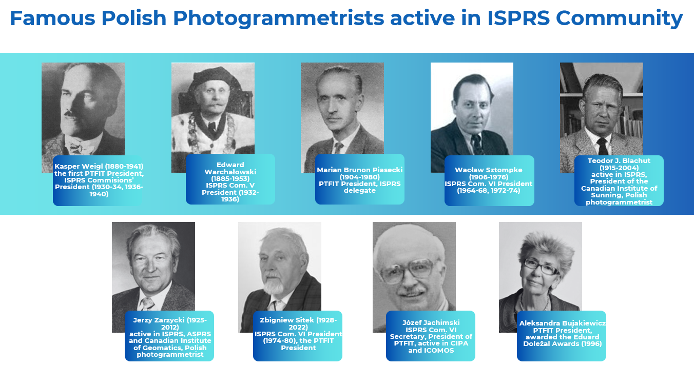
The Polish Society for Photogrammetry and Remote Sensing (PTFIT)
WAn ordinary member of ISPRS from Poland, a group of almost 100 professionals, including entrepreneurs, scientists, and representatives of the administration, it organises conferences, workshops, trainings, and gives opinions on amended legal acts, and promotes good practices of obtaining and processing terrestrial, airborne, and satellite geospatial data. PTFIT was founded in 1930, and after World War II, it reactivated its activity within the Association of Polish Surveyors (SGP), of which it remains a scientific and technical section with an independent board and praesidium.
PTFiT website www
The Association of Polish Surveyors (SGP)
is an organization with over 100 years of tradition associating surveyors and cartographers. The SGP currently has several thousand members. In recent years, the Association has organized many events, but the most important was the successful FIG World Congress in 2022, attended by over 1,200 people from around the world. Experience from this event guarantees obtaining the highest level of GSW 2027 organization.
Poland is a large market of Geospatial Services
The photogrammetry, remote sensing, and GIS services market in Poland has been growing steadily due to the increasing demand for advanced mapping and spatial data analysis across various industries. These technologies are widely applied in sectors like urban planning, environmental monitoring, agriculture, construction, and transportation. With the continuous development of drone technology, photogrammetry services have become more accessible, allowing for high-resolution aerial imagery to create precise 3D models and maps.
Strong and recognized Polish photogrammetric companies
The photogrammetry and remote sensing sectors are also being bolstered by Poland’s strong focus on digital transformation and technological innovation. This is further supported by the increasing investments in geospatial data infrastructure and the rise of cloud-based GIS solutions, which allow for easier access and collaboration on spatial data. Polish companies are well-known in Europe in aerial surveying, but they also have many geospatial services in their portfolio to provide solutions for urban and environmental monitoring
Satellite remote sensing and space market
Poland can boast over 500 years of experience in space research and exploration. Their foundations were the revolutionary ideas of Nicolaus Copernicus and his followers, including Jan Heweliusz, great Polish astronomers, 20th century and scientists working today. Over the years, scientists and engineers of Polish origin, working in Poland and abroad, have created many valuable scientific concepts, inventions and devices that have become a permanent part of the history of space exploration. Today, Polish companies also develop satellite solutions for remote sensing
Active GIS market
In Poland, the use of GIS has expanded significantly, particularly in the fields of land management, forestry, and infrastructure development. The ability to collect and analyse large datasets has become a valuable tool for decision-making processes at both public and private levels. The demand for GIS solutions is growing among government agencies, municipalities, and private companies seeking to optimise resources and improve the efficiency of operations.
Large number of universities educating in geospatial field
Poland's academic and research institutions play a significant role in advancing the field by conducting studies, fostering innovation, and developing new techniques. The growing adoption of these technologies has also led to a rise in specialised training and certification programs for professionals working in the field of geospatial data.
In Poland, we teach Photogrammetry, Remote Sensing and GIS mostly in the following courses: geodesy and cartography (education of surveyors and geospatial engineers) and geography (academic course for geographers).
In 2024, we had 6378 students of geodesy and cartography and 2333 of geography (8711 in total). The following map shows the distribution of our students showing location of Universities teaching in geospatial courses
Polish Universities educating in geodesy and cartography (orange) and geography (green) with label showing the number of students in geospatial courses in 2024 (by dr. Wojciech Ostrowski)